| Proposed Plans |
Ohio's Plan | Cuyahoga County's Plans |
Cleveland's Plan |
Present Agreement |
Port Authority's Master Plan |
"Friends" Home Page |
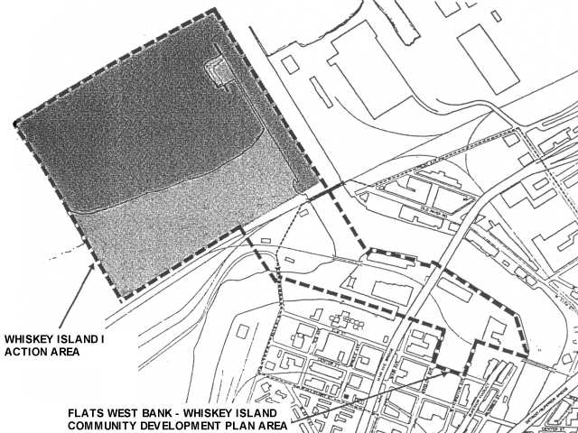
Cleveland's plan for the development and improvement of Whiskey IslandIn 1988 the City of Cleveland's Planning Commission, under the direction of Hunter Morrison, completed a plan for Whiskey Island. The plan was made official through City ordinance 1878-88. The ordinance referred to Whiskey Island as a "blighted and deteriorated area" and that the Plan would "afford maximum opportunity consistent with the sound needs of the City as a whole" and gives "due consideration to the provisions of adequate open space, park and recreational areas appropriate to the area..." FLATS WEST BANK-WHISKEY ISLAND
|